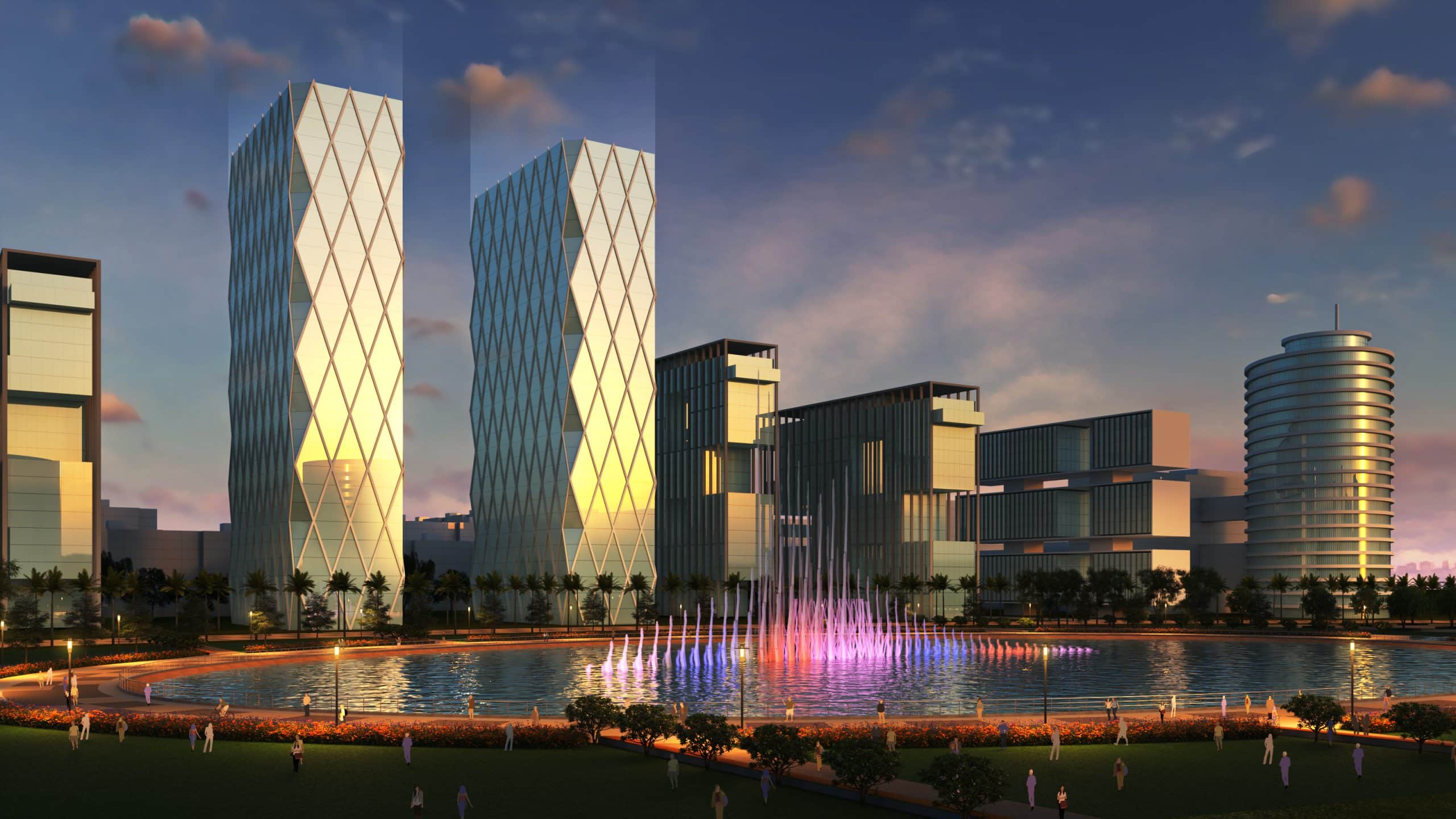
Rajkot Smart City Masterplan Under
Smart Cities Mission, Govt. of India
Rajkot, Gujarat, India
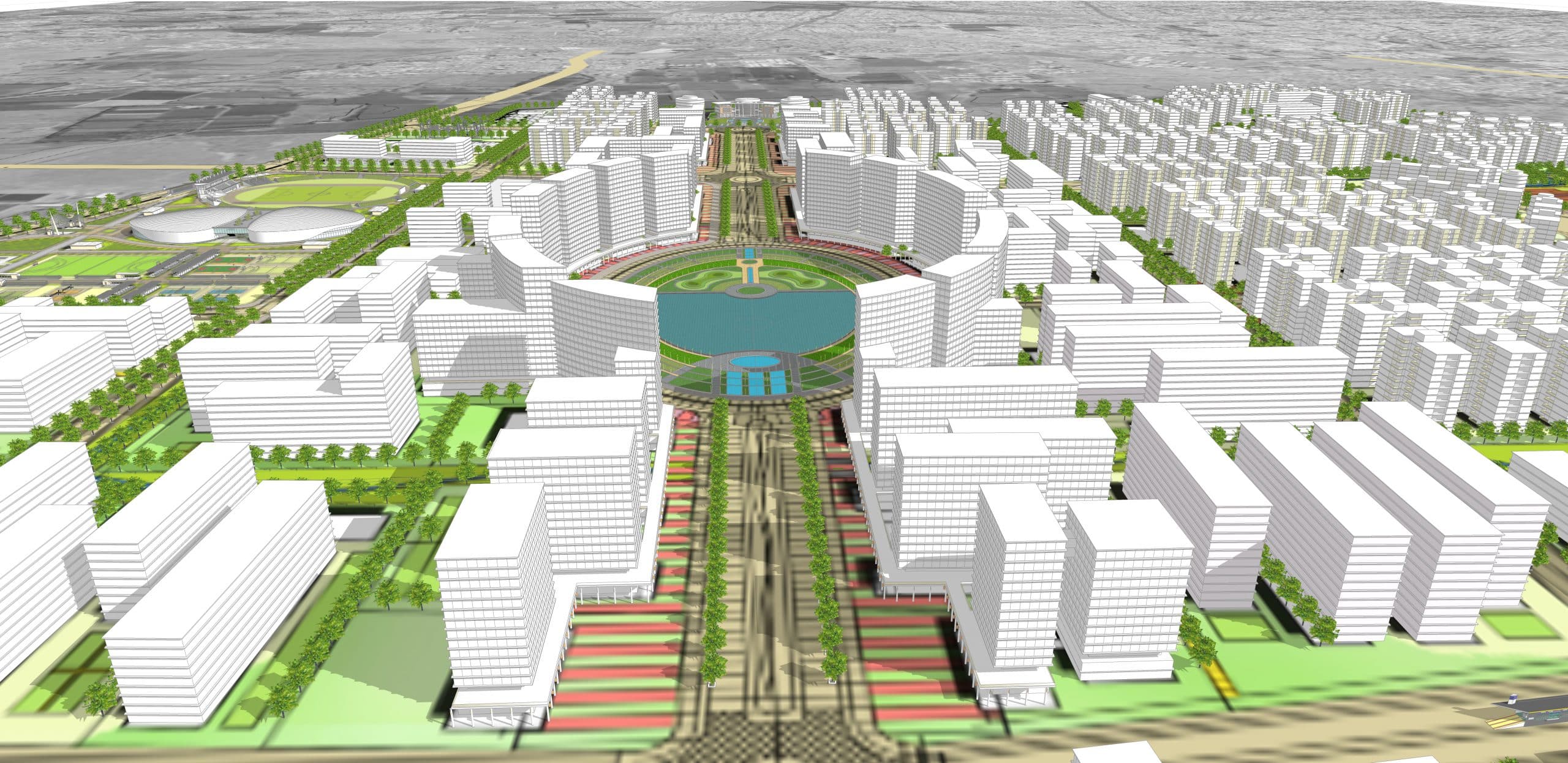
The project involves development of a Green Field Area covering approximately 930 acres of land with an estimated project cost of Rs 2100 cr. The project is envisaged to have world class, Smart physical infrastructure with utilities that are environment friendly, sustainable, functionally smart and technology driven. The design emphasizes on developing walkable localities and promoting a multi-modal transport network. Providing an enabling design for a cohesive NMT network is one of the salient features of the project. Preserving and developing open spaces such as parks, lake front and other recreational spaces for a vibrant public domain and also to maintain the eco-balance is another key feature of the design. The plan focuses on developing mixed land use to enhance the efficiency of land use and create a pool of compatible activities close to one another.
Site Area : 907 Acres
Builtup Area : 6,03,92,124 SF
Services : Feasibility Study, Programming, Master Planning, Smart Robust Infrastructure, Transportation, Social Infrastructure, Architecture (Social Buildings Concept), Engineering, Landscape Design, Project Management Consultancy (PMC), Urban Design, District Cooling, Non-Motorized Network (NMT), Sustainability & Green Certification
Accolade : IGBC Green City Platinum Rating
Share ►
Translating Smart as Green, Polycentric and Efficient
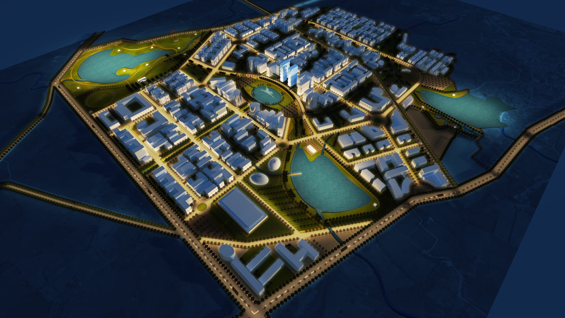
Out of the 100 Smart Cities planned across India, Rajkot was one of the very few offering an abutting green-field area, an expansive 930 acres, to be developed as Rajkot Smart City. The exercise that yielded some rewarding results with interesting insights, began with identifying some existing assets like waterbodies and earmarked public land for utilities which ended up being utilizing anchors around which the entire scheme fascinatingly revolves. Identified waterbodies have been interlinked using water channels flowing along the site’s natural watershed. Greens belts, accounting for 29% of the land area, are laid out on either sides to create a continuous pedestrian walkway with an integrated NMT route throughout the city. After establishing an efficient 21 kms of road network around blocks desirably small sized to offer an easy pedestrian access across them, each block gets identified by a public utility it holds revealing 5 distinct districts covering the city – institutional, recreational, sports, convention, mixed use and central. This poly-centered denouement around fixed anchor points, tied up by well networked water channels, greenbelts and roads, is then aligned to the TP Scheme plans prepared by RSCDL/ RMC to arrive at the final detailed masterplan.
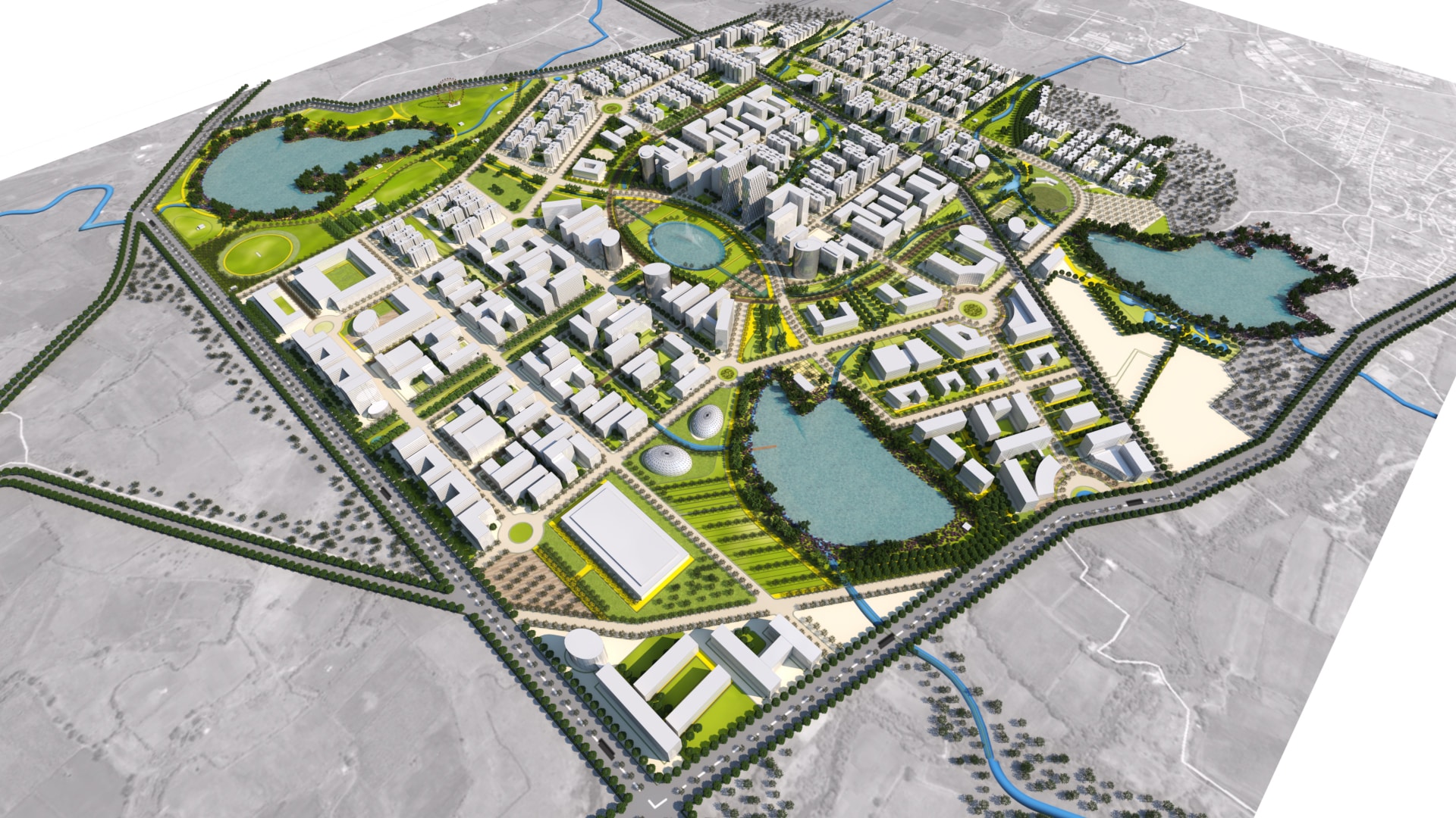
Location and Control of Critical Infrastructure – Key to Design Performance
Locating different public utilities like sports facilities, convention centers or institutions on government owned lands in different blocks proved critical to achieving the desired decentralization and consequent scheme efficiency. Further, a central command and control facility to run the service networks on a daily basis acts as the glue that ensures operational coalescence, again contributing to the same efficiency. Other key infrastructure provisions like district cooling, water network, BRTS enhance the smart quotient while affordable housing for 5000 families with well-planned amenities like school, hospital, transport hub make the city equitable for all citizens.
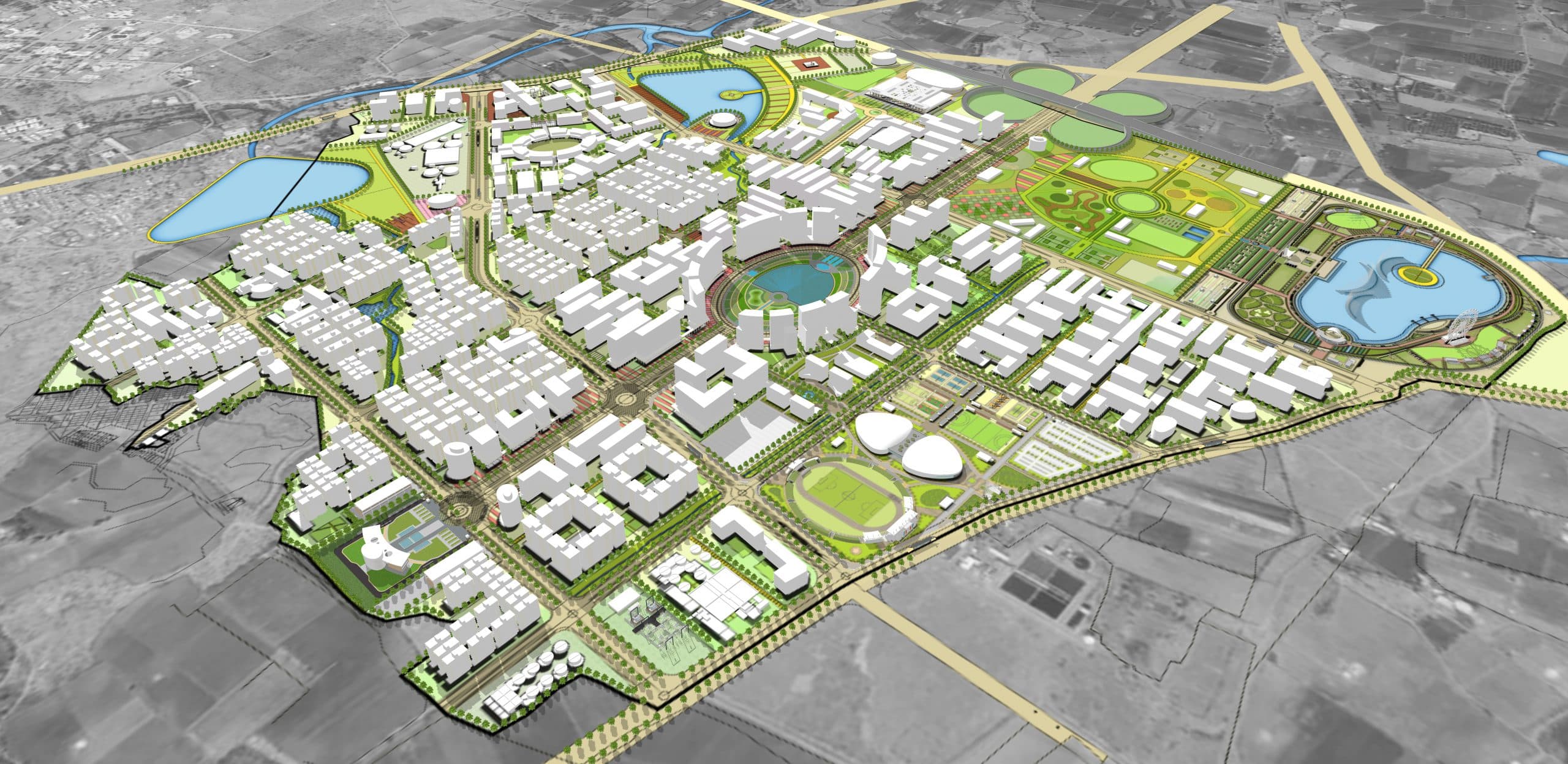
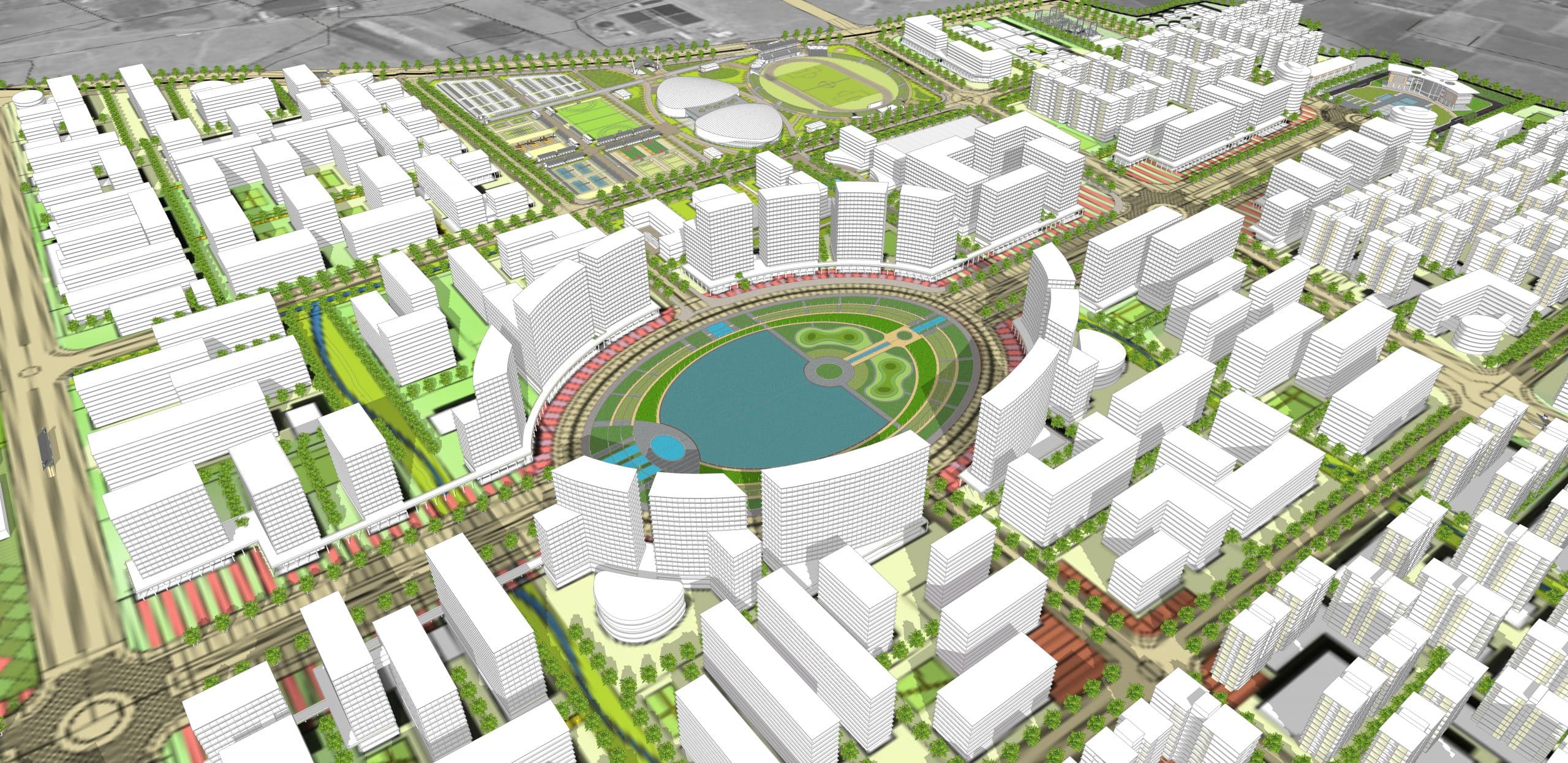
Integration and Penetration of Mobility & Green Networks
Networking waterbodies allowed a near equitable spread of green lungs, walkways and water features, penetrating almost every corner of the plan. Despite a decentralized layout, the road network achieves efficient point-to-point access, comparable to that delivered by centralized circular geometry.
Making Smart Sustainable by Intuitive Integration of Networks
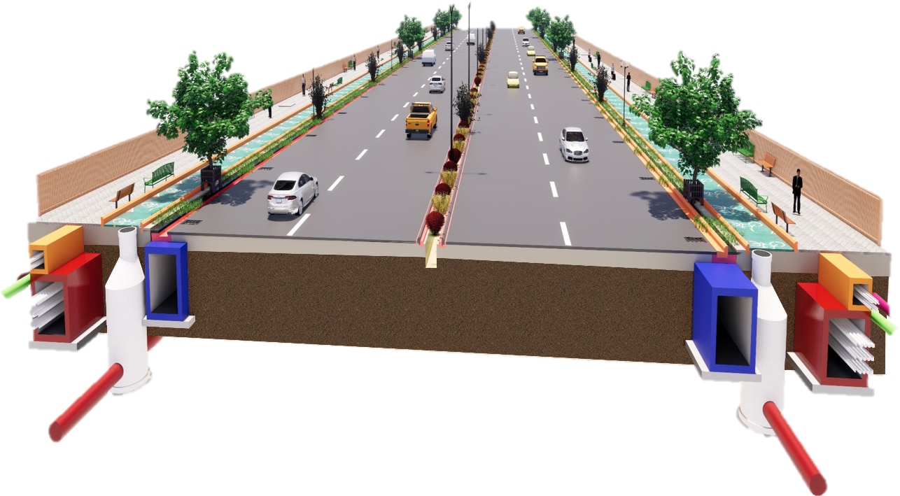
3D Bim Model of road typical cross section-24-36 mtr row
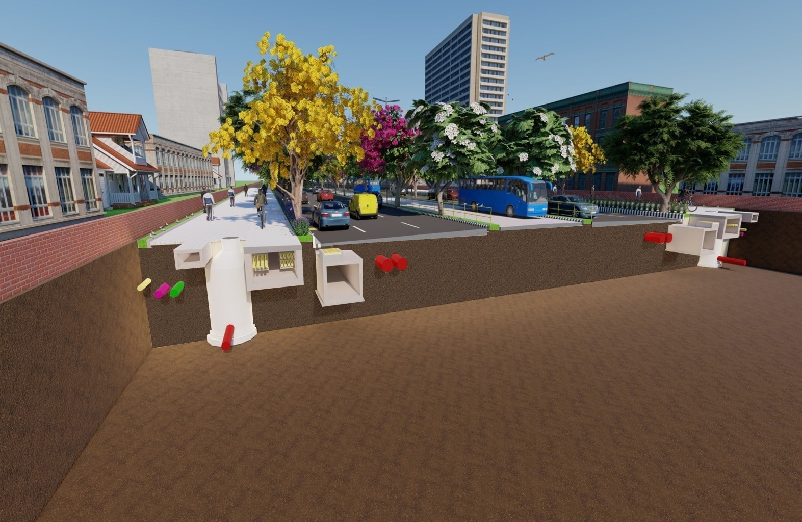
45 M Right of way
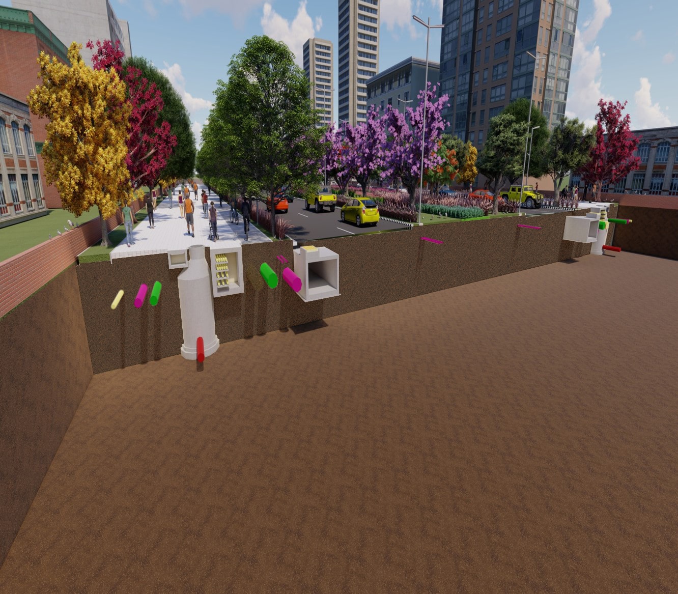
60 M Right of way
"Applying Foresight and Integration to Sustain the Smart in Urban Fabrics"

